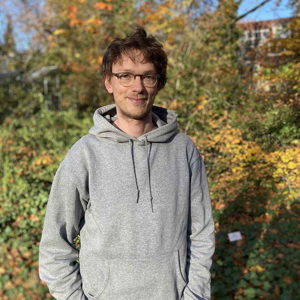
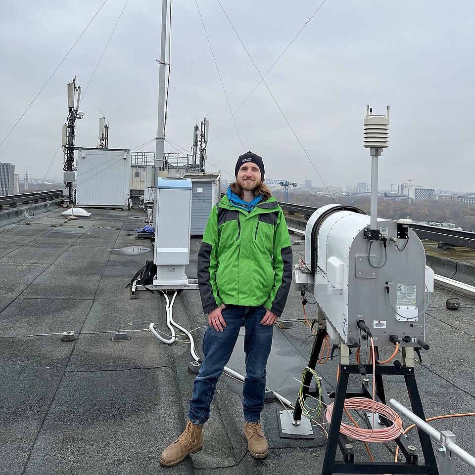
Prof. Dr. Dieter Scherer
Werdegang
- 1982-1989: Lehramtsstudium Physik und Geographie an der Universität Freiburg, Deutschland.
- 1984-1990: Diplomstudium der Physik an der Universität Freiburg, Deutschland.
- 1994: Promotion zum Dr. phil. im Fach Meteorologie durch die Philosophisch-Naturwissenschaftliche
Fakultät der Universität Basel, Schweiz, mit dem Prädikat "summa cum laude".
Titel der Dissertation: Slush stream initiation in a High Arctic drainage basin in NW-Spitsbergen -
An energy balance based approach combining field methods, remote sensing and numerical modelling.
- 1999: Abschluss der Habilitation im Fach Geographie und Verleihung der "venia docendi" sowie
Ernennung zum Privatdozenten durch die Philosophisch-Naturwissenschaftliche Fakultät der
Universität Basel, Schweiz.
Titel der Habilitationsschrift: Regionale Geosystemanalyse - Theorie und Beispiele.
- 2003: Ernennung zum Universitätsprofessor und Leiter des Fachgebiets Klimatologie
am Institut für Ökologie der Technischen Universität Berlin.
Forschungsprojekte
Weitere wissenschaftliche Tätigkeiten
- Reviewer für zahlreiche wissenschaftliche Zeitschriften
(u.a. Remote Sensing of Environment, Journal of Glaciology, Theoretical and Applied Climatology)
- Convener der European Geosciences Union (EGU) für die Session: "Mass and Energy Balance of Snow and Ice"
- Mitglied von Organisations- und Auswahlkommissionen wissenschaftlicher Konferenzen, Tagungen und Workshops
(u.a. für die European Association of Remote Sensing Laboratories (EARSeL))
- Gutachter für BMBF, NASA, NSERC Canada
- National Chief Delegate (Schweiz) der Northern Research Basins (NRB) bis 2001
Ausgewählte Publikationen
- Jänicke, B., Holtmann, A., Kim, K.R., Kang, M., Fehrenbach, U., Scherer, D. (2019): Quantification and evaluation of intra-urban heat-stress variability in Seoul, Korea.
Int. J. Biometeorol. 63: 1-12.
Link
- Fenner, D., Holtmann, A., Krug, A., Scherer, D. (2018): Heat waves in Berlin and Potsdam, Germany - Long-term trends and comparison of heat
wave definitions from 1893 to 2017. Int. J. Climatol.: 1-16.
Link
- Fenner, D., Meier, F., Bechtel, B., Otto, M. & D. Scherer (2017): Intra and inter local climate zone variability of air temperature as observed by
crowdsourced citizen weather stations in Berlin, Germany.
Meteorol. Z.. Online first. Link
- Meier, F., Fenner, D., Grassmann,T., Otto, M. & D. Scherer (2017): Crowdsourcing air temperature from citizen weather stations for urban climate research.
Urban Climate 19: 170-191.
Link
- Bahi, H., Rhinane, H., Bensalmia, A., Fehrenbach, U. and D. Scherer (2016):
Effects of Urbanization and Seasonal Cycle on the Surface Urban Heat Island Patterns in the Coastal Growing Cities: A Case Study of Casablanca,
Morocco.
Remote Sens. 2016, (8) 829.
Link
- Buchin, O., Jänicke, B., Meier, F., Scherer, D. & F. Ziegler (2016): The role of building models in the evaluation of heat-related risks.
Nat. Hazards Earth Syst. Sci. 16: 963-976.
Link
- Curio, J. & D. Scherer (2016): Seasonality and spatial variability of dynamic precipitation controls on the Tibetan Plateau.
Earth System Dynamics 7: 767-782.
Link
- Jänicke, B., Meier, F., Lindberg, F., Schubert, S. & D. Scherer (2016): Towards city-wide, building-resolving analysis of mean radiant temperature.
Urban Climate 15: 83-98.
Link
- Jänicke, B., F. Meier, D. Fenner, U. Fehrenbach, A. Holtmann, D. Scherer (2016): Urban-rural differences in near-surface air temperature as resolved
by the Central Europe Refined analysis (CER): sensitivity to planetary boundary layer schemes and urban canopy models.
International Journal of Climatology 37 (4), 2063-2079.
Link
- Yi, C., Kim, K. R., An, S. M.,Choi, Y.-J., Holtmann, A., Jänicke, B., Fehrenbach, U. and D. Scherer (2016): Estimating spatial patterns of air
temperature at building-resolving spatial resolution in Seoul, Korea.
International Journal of Climatology 36(2) 533–549.
Link
- Burkart, K., Meier, F., Schneider, A., Breitner, S., Canário, P., Alcoforado, M. J., Scherer, D. & W. Endlicher (2015):
Modification of Heat-Related Mortality in an Elderly Urban Population by Vegetation (Urban Green) and Proximity to Water (Urban Blue):
Evidence from Lisbon, Portugal.
Environmental Health Perspectives 124 (7), 927-934.
Link
- Curio, J., Maussion, F. & D. Scherer (2015): A 12-year high-resolution climatology of atmospheric water transport over the Tibetan Plateau.
Earth Syst. Dynam. 6: 109-124.
Link
- Curio, J., Fehrenbach, U., Höpfner, C., Scherer, D., Amraoui, F. & H. Rhinane (2015):
Methods for complex knowledge production: Numerical Modelling. In:
Urban Agriculture for Growing City Regions. Connecting Urban-Rural Spheres in Casablanca: 95.
Link
- Fehrenbach, U., Curio, J., Höpfner, C., Scherer, D., Amraoui, F., Mansour, M. & H. Rhinane (2015):
Deepening the problem analysis: Natural hazards and risks. In:
Urban Agriculture for Growing City Regions. Connecting Urban-Rural Spheres in Casablanca: 212-216.
Link
- Fehrenbach, U., Helten, F., Scherer, D. & H. Rhinane (2015): Strategies and actions: Open access to knowledge.
In: Urban Agriculture for Growing City Regions. Connecting Urban-Rural Spheres in Casablanca: 462-467.
Link
- Feiertag, P., Giseke, U., Brand, C., Chlaida, M., Helten, F., Scherer, D., Ouchker, J., Amraoui, F. & M. Mdafai (2015):
Strategies and actions: The UAC Action Plan for Grand Casablanca. In:
Urban Agriculture for Growing City Regions. Connecting Urban-Rural Spheres in Casablanca : 468-477.
Link
- Feiertag, P., Naismith, I.-C., Heinze, M., Brand, D., Fehrenbach, U., Gerster-Bentaya, M., Helten, F., Kasper, C., Scherer, D., Giseke, U.,
Chlaida, M., Mansour, M. & F. Amraoui (2015): Grand Casablanca 2025: Integrated scenarios. In:
Urban Agriculture for Growing City Regions. Connecting Urban-Rural Spheres in Casablanca: 223-232.
Link
- Giseke, U., Gerster-Bentaya, M., Helten, F., Kraume, M., Scherer, D., Spars, G., Adidi, A., Amraoui, F., Berdouz, S., Chlaida, M., Mansour, M.
& M. Mdafai (2015): Dealing with five major challenges of growing city regions. In:
Urban Agriculture for Growing City Regions. Connecting Urban-Rural Spheres in Casablanca: 19-27.
Link
- Giseke, U., Gerster-Bentaya, M., Helten, F., Kraume, M., Scherer, D., Spars, G., Adidi, A., Amraoui, F., Berdouz, S., Chlaida, M., Mansour, M.
& M. Mdafai (2015): The UAC research approach: Problems, questions and definitions. In:
Urban Agriculture for Growing City Regions. Connecting Urban-Rural Spheres in Casablanca: 28-36.
Link
- Giseke, U., Helten, F., Spars, G., Scherer, D., Mdafai, M., Berdouz, S., Amraoui, F., Mansour, M., Ouchker, J. & J. Brandt (2015):
Strategies and actions: Dealing with constraints: Limitations of the problem solutions. In:
Urban Agriculture for Growing City Regions. Connecting Urban-Rural Spheres in Casablanca: 478-486.
Link
- Heinze, M., Gerster-Bentaya, M., Helten, F., Prystav, G. & D. Scherer (2015): The economic impacts of urban agriculture: The economic impact of
the Pilot Projects. In:
Urban Agriculture for Growing City Regions. Connecting Urban-Rural Spheres in Casablanca: 418-429.
Link
- Höpfner, C., Fehrenbach, U., Scherer, D. & H. Rhinane (2015): Methods for complex knowledge production: Earth observation. In:
Urban Agriculture for Growing City Regions. Connecting Urban-Rural Spheres in Casablanca: 94.
Link
- Jänicke, B., Meier, F., Hoelscher, M.-T. & D. Scherer (2015): Evaluating the Effects of Facade Greening on Human Bioclimate in a Complex Urban Environment
In:
Advances in Meteorology Vol. 2015 (2015).
Link
- Kasper, C., Brand, C., Brandt, J., Fehrenbach, U., Gerster-Bentaya, M., Giseke, U., Heinze, M., Helten, F., Kraume, M., Scherer, D., Chlaida,
M., Mansour, M. & M. Mdafai (2015): Connecting spheres: Urban agriculture as a multi-dimensional strategy: A way to make it work:
multifunctional spatial systems. In:
Urban Agriculture for Growing City Regions. Connecting Urban-Rural Spheres in Casablanca: 346-366.
Link
- Kasper, C., Giseke, U., Brand, C., Brandt, J., Gerster-Bentaya, M., Helten, F., Kraume, M., Scherer, D., Mansour, M. & M. Chlaida (2015):
Connecting spheres: Urban agriculture as a multi-dimensional strategy: Five integrative sub-concepts. In:
Urban Agriculture for Growing City Regions. Connecting Urban-Rural Spheres in Casablanca: 330-344.
Link
- Mdafai, M & D. Scherer (2015): Presentation of Grand Casablanca: City profile. In:
Urban Agriculture for Growing City Regions. Connecting Urban-Rural Spheres in Casablanca: 55-59.
Link
- Neckel, N., Kropáček, J., Schröter, B. and D. Scherer (2015): Effects of Cyclone Hudhud captured by a high altitude Automatic Weather Station in
northwestern Nepal.
Weather 70(7): 208–210.
Link
- Rhinane, H., Fehrenbach, U., Höpfner, C. & D. Scherer (2015): Methods for complex knowledge production: Information and communication platforms. In:
Urban Agriculture for Growing City Regions. Connecting Urban-Rural Spheres in Casablanca: 98.
Link
- Scherer, D., Brand, C., Brandt, J., Fehrenbach, U., Gerster-Bentaya, M., Prystav, G., Amraoui, F., Berdouz, S. & M. Chlaida (2015):
Urban agriculture’s contribution to a climate-optimized urban development: Climate optimized urban development and urban agriculture:
the local level. In:
Urban Agriculture for Growing City Regions. Connecting Urban-Rural Spheres in Casablanca: 388-395.
Link
- Scherer, D., Curio, J., Fehrenbach, U., Höpfner, C., Amraoui, F., Berdouz, S., Chlaida, M. & A. Ouldbba (2015): Problem oriented analysis:
Environmental conditions. In:
Urban Agriculture for Growing City Regions. Connecting Urban-Rural Spheres in Casablanca: 126-131.
Link
- Scherer, D., Curio, J., Fehrenbach, U., Höpfner, C., Amraoui, F. & A. Ouldbba (2015): Problem oriented analysis: Climate. In:
Urban Agriculture for Growing City Regions. Connecting Urban-Rural Spheres in Casablanca: 132-150.
Link
- Scherer, D., Curio, J., Fehrenbach, U., Höpfner, C., Amraoui, F., Berdouz, S., Chlaida, M. & H. Rhinane (2015): Deepening the problem analysis:
Natural resources. In:
Urban Agriculture for Growing City Regions. Connecting Urban-Rural Spheres in Casablanca: 204-211.
Link
- Scherer, D., Fehrenbach, U., Höpfner, C., Amraoui, F., Ouldbba, A. & H. Rhinane (2015): Urban agriculture’s contribution to a
climate-optimized urban development: Climate optimized urban development and Urban Agriculture: the regional level. In:
Urban Agriculture for Growing City Regions. Connecting Urban-Rural Spheres in Casablanca: 382-387.
Link
- Fenner, D., Meier, F., Scherer, D. & A. Polze (2014): Spatial and temporal air temperature variability in Berlin, Germany, during the years 2001-2010.
Urban Climate 10: 308–331.
Link
- Jehn, M., Gebhardt, A., Liebers, U., Kiran, B., Scherer, D., Endlicher, W. & C. Witt (2014): Heat Stress is Associated with Reduced Health Status
in Pulmonary Arterial Hypertension: A Prospective Study Cohort.
Lung 192(4): 619-624.
Abstract
- Kim, K. R., Yi, C., Lee, J.-S., Meier, F., Jänicke, B., Fehrenbach, U. & D. Scherer (2014): BioCAS: Biometeorological Climate impact Assessment
System for building-scale impact assessment of heat-stress related mortality.
Die Erde 145 (1-2): 62-79.
Link
- Maussion, F., Scherer, D., Mölg, T., Collier, E., Curio, J. & R. Finkelnburg (2014): Precipitation Seasonality and Variability over the Tibetan
Plateau as Resolved by the High Asia Reanalysis.
Journal of Climate 27(5): 1910-1927.
Link
- Mölg, T., Maussion, F. & D. Scherer (2014): Mid-latitude westerlies as a driver of glacier variability in monsoonal High Asia.
Nature Climate Change 4: 68-73.
Link
- Otto, M.,C. Höpfner, D. Scherer, J. Curio and F. Maussion (2014): Assessing vegetation response to precipitation in northwest Morocco during the last
decade: an application of MODIS NDVI and high resolution reanalysis data.
Theoretical and Applied Climatology 123(1-2): 23-41.
Link
- Scherer, D. & W. Endlicher (2014): Editorial: Urban climate and heat stress. – Part 2 –
Die Erde – Journal of the Geographical Society of Berlin Vol 145, No 1-2.
Link
- Scherer, D. & W. Endlicher (2014): Editorial: Urban climate and heat stress. – Part 1 –
Die Erde – Journal of the Geographical Society of Berlin Vol 144, No 3-4.
Link
- Collier, E., Mölg, T., Maussion, F., Scherer, D., Mayer, C. & A. B. G. Bush (2013):
High-resolution interactive modelling of the mountain glacier-atmosphere interface: an application over the Karakoram.
The Cryosphere 7: 779–795.
Link
- Jehn, M., Donaldson, G., Kiran, B., Liebers, U., Mueller, K., Scherer, D., Endlicher, W. & C. Witt (2013): Tele-monitoring reduces exacerbation
of COPD in the context of climate change – a randomized controlled trial.
Environmental Health 12–99.
Link
- Eum, J.-H., Scherer, D., Fehrenbach, U., Köppel, J. & J.-H. Woo (2013): Integrating urban climate into urban master plans using spatially
distributed information – The Seoul example.
Land Use Policy 34: 223-232.
Link
- Möller, M., Finkelnburg, R., Braun, M., Scherer, D. & C. Schneider (2013): Variability of the climatic mass balance of Vestfonna ice cap,
northeastern Svalbard, 1979-2011.
Annals of Glaciology 54(63): 254-264.
Link
- Sauter, T., Moeller, M., Finkelnburg, R., Grabiec, M., Scherer, D., & C. Schneider (2013): Snowdrift modelling for the Vestfonna ice cap, north-eastern
Svalbard.
The Cryosphere 7: 12871301.
Link
- Scherer, D. & W. Endlicher (eds.) (2013): Urban climate and heat stress – Part 1. In:
Die Erde – Journal of the Geographical Society of Berlin 144 (3-4).
Link
- Scherer, D. & W. Endlicher (2013): Editorial: Urban climate and heat stress. – Part 1. –
Die Erde – Journal of the Geographical Society of Berlin 144(3-4): 175-180.
Link
- Scherer, D., Fehrenbach, U., Lakes, T., Lauf, S., Meier, F. & C. Schuster (2013): Quantification of heat-stress related mortality hazard, vulnerability
and risk in Berlin, Germany.
Die Erde – Journal of the Geographical Society of Berlin 144 (3-4): 238-259.
Link
- Zhang, G., Kang, S., Fujita, K., Wei, Y., Huintjes, E., Xu, J., Yamazaki, T., Haginoya, S., Scherer, D., Schneider, C. & T. Yao (2013):
Energy and mass balance of Zhadang glacier surface, central Tibetan Plateau.
Journal of Glaciology 59(213): 137-148.
Link
- Christen, A., Meier, F. & D. Scherer (2012): High-frequency fluctuations of surface temperatures in an urban environment.
Theoretical and Applied Climatology 108 (1-2): 301-324.
Link
- Meier, F. & D. Scherer (2012): Spatial and temporal variability of urban tree canopy temperature during summer 2010 in Berlin, Germany.
Theoretical and Applied Climatology 110 (3): 373-384.
Link
- Mölg, T., Maussion, F., Yang, W. & D. Scherer (2012): The footprint of Asian monsoon dynamics in the mass and energy balance of a Tibetan glacier.
The Cryosphere 6: 1445-1461.
Link
- Mölg, T. & D. Scherer (2012): Retrieving important mass-balance model parameters from AWS measurements and high-resolution mesoscale
atmospheric modeling.
Journal of Glaciology 58(209): 625-628.
Link
- Yi, C.-Y., Kim, K.-R., Choi, Y.-J., Won, H. Y. & D. Scherer (2012): Nocturnal Surface Cooling and Cold Air Transport Analysis Based on High Density
Observation - A Case Study of Eunpyeong New Town in Seoul.
Journal of the Korean Association of Geographic Information Studies 15(4): 124-137.
Link
- Yi, C.-Y., An, S.-M., Kim, K.-R., Choi, Y.-J. & D. Scherer (2012): Improvement of Air Temperature Analysis by Precise Spatial Data on a
Local-scale - A Case Study of Eunpyeong New Town in Seoul.
Journal of the Korean Association of Geographic Information Studies 15(1): 144-158.
Link
- Beaudon, E., Arppe, L., Jonsell, U., Martma, T., Moeller, M., Pohjola, V. A., Scherer, D. & J. C. Moore (2011):
Spatial and temporal variability of net accumulation from shallow cores from Vestfonna ice cap (Nordaustlandet, Svalbard).
Geografiska Annaler: Series A, Physical Geography 93(4): 287-299.
Link
- Braun, M., Pohjola, V. A., Pettersson, R., Moeller, M., Finkelnburg, R., Falk, U., Scherer, D. & C. Schneider (2011):
Changes of glacier frontal positions of Vestfonna (Nordaustlandet, Svalbard).
Geografiska Annaler: Series A, Physical Geography 93(4): 301-310.
Link
- Eum, J.-H., Scherer, D., Fehrenbach, U. & J.-H. Woo (2011): Development of an urban landcover classification scheme suitable for representing
climatic conditions in a densely built-up Asian megacity.
Landscape and Urban Planning 103(3-4): 362-371.
Link
- Höpfner, C. & D. Scherer (2011): Analysis of vegetation and land cover dynamics in north-western Morocco during the last decade using
MODIS NDVI time series data.
Biogeosciences 8: 3359-3373.
Link
- Maussion, F., Scherer, D., Finkelnburg, R., Richters, J., Yang, W. & T. Yao (2011): WRF simulation of a precipitation event over the Tibetan Plateau,
China – an assessment using remote sensing and ground observations.
Hydrology and Earth System Sciences 15: 1795-1817.
Link
- Möller, M., Finkelnburg, R., Braun, M., Hock, R., Jonsell, U., Pohjola, V., Scherer, D. & C. Schneider (2011): Climatic mass balance of the
ice cap Vestfonna, Svalbard: A spatially distributed assessment using ERA-Interim and MODIS data.
Journal of Geophysical Research 116 (F3).
Link
- Möller, M., Möller, R., Beaudon, E., Mattila, O.-P., Finkelnburg, R., Braun, M., Braun, M., Grabiec, M., Jonsell, U., Luks, B., Puczko, D.,
Scherer, D. & C. Schneider (2011): Snowpack Characteristics of Vestfonna and de Geerfonna (Nordaustlandet, Svalbard) - A Spatiotemporal
Analysis Based on Multiyear Snow-Pit Data.
Geografiska Annaler: Series A, Physical Geography 93 (4): 273-285.
Link
- Meier, F., Scherer, D., Richters, J. & A. Christen (2011): Atmospheric correction of thermal-infrared imagery of the 3-D urban environment
acquired in oblique viewing geometry.
Atmospheric Measurement Techniques 4: 909-922.
Link
- Otto, M., Scherer, D. & J. Richters (2011): Hydrological differentiation and spatial distribution of high altitude wetlands in a semi-arid Andean
region derived from satellite data.
Hydrology and Earth System Sciences 15: 1713-1727.
Link
- von Bobrutzki, K., Ammon, C., Berg, W., Einert, P., Fiedler, M., Müller, H.-J., Scherer, D. & B. Strohbach (2011): Ammonia emissions from a broiler
farm: spatial variability of airborne concentrations in the vicinity and impact on adjacent woodland.
Environmental Monitoring and Assessment 184(6): 3775-3787.
Link
- von Bobrutzki, K., Müller, H. J. & D. Scherer (2011): Factors affecting the ammonia content in the air surrounding a broiler farm.
Biosystems Engineering 108(4): 322-333.
Link
- Yi, C.-Y., Eum, J.-H., Choi, Y.-J., Kim, K.-R., Scherer, D., Fehrenbach, U. & G.-H. Kim (2011): Development of Climate Analysis Seoul(CAS) Maps Based on
Landuse and Meteorogical Model.
Journal of the Korean Association of Geographic Information Studies 14(1): 12–25.
Link
- Bolch, T., Yao, T., Kang, S., Buchroithner, M. F., Scherer, D., Maussion, F., Huintjes, E. & C. Schneider (2010):
A glacier inventory for the western Nyainqentanglha Range and Nam Co Basin, Tibet, and glacier changes 1976–2009.
The Cryosphere 4: 419-433. Link
- Meier, F., Scherer, D. & J. Richters (2010): Determination of persistence effects in spatio-temporal patterns of upward long-wave radiation
flux density from an urban courtyard by means of Time-Sequential Thermography.
Remote Sensing of Environment 114(1): 21-34.
Link
- Scherer, D. (2006): Chapter 7.7: “Ice and snow”. In:
Cost-Effective Earth Observation Missions, Taylor & Francis.
- Scherer, D. et al. (2005): Remote sensing of snow cover. In:
Remote Sensing in Northern Hydrology: Measuring Environmental Change, Edited by Duguay, C.R. and A. Pietroniro, Geophysical Monograph 163,
American Geophysical Union, Washington, DC, 7-38.
Link
- Müller, M. & D. Scherer (2005): A grid- and subgrid-scale radiation parameterization of topographic effects for mesoscale weather forecast models,
Monthly Weather Review 133(6): 1431–1442.
Link
- Winther, J.-G., Bindschadler, R., König, M. & D. Scherer (2005): Remote sensing of glaciers and ice sheets. In:
Remote Sensing in Northern Hydrology: Measuring Environmental Change, Edited by Duguay, C.R. and A. Pietroniro, Geophysical Monograph 163,
American Geophysical Union, Washington, DC, 39-62.
Link
- Arck, M. & D. Scherer (2002): Problems in the determination of sensible heat flux over snow.
Geografiska Annaler: Series A, Physical Geography 84A(3-4): 157-169.
Link
- Bartsch, A., Gude, M., C. Jonasson & D. Scherer (2002): Identification of geomorphic process units in Kärkevagge, northern Sweden,
by remote sensing and digital terrain analysis.
Geografiska Annaler: Series A, Physical Geography 84A(3-4): 171-178.
Link
- Gude, M., G. Daut, S. Dietrich, R. Mäusbacher, C. Jonasson, A. Bartsch & D. Scherer (2002):
Towards an integration of process measurements, archive analysis and modelling in geomorphology – the Kärkevagge experimental site,
Abisko area, northern Sweden.
Geografiska Annaler: Series A, Physical Geography 84 (3-4): 205-212.
Link
- Scherer, D. (2002): Earth observation by remote sensing in the context of GIS - Particular requirements of developing countries.
Abstract Book EARSeL Workshop ‘Remote Sensing for Developing Countries’, Bonn: 18-19.
- Scherer, D. & M. Meininger (2002): Segmentbasierte Klassifikation von Rasterdaten unter Verwendung pixelbasierter Klassifikatoren. In:
Angewandte Geographische Informationsverarbeitung XIV. Beiträge zum AGIT-Symposium Salzburg 2002.
Link
- Arck, M. & D. Scherer (2001): A physically based method for correcting temperature data measured by naturally ventilated sensors over snow.
Journal of Glaciology 47(159): 665-670.
Link
- Fehrenbach, U., D. Scherer & E. Parlow (2001): Automated classification of planning objectives for the consideration of climate and air
quality in urban and regional planning for the example of the region of Basel/Switzerland.
Atmospheric Environment 35(32): 5605-5615.
Link
- Gude, M., C. Jonasson, S. Dietrich & D. Scherer (2001): Assessment of variability in fluvial sediment transfer in Kärkevagge (N-Sweden)
during the last 50 years.
Nordic Hydrology 31: 373-384.
Abstract
- Parlow, E., Fehrenbach, U., Scherer, D. & H.-D. Beha (2001): Klimaanalysekarten der Region Basel. In:
REKLIP-Synthesebericht, Band 4: Klima und Raumplanung. Editions Coprur, Strasbourg: 169-186.
- Scherer, D. (2001): GIS-based glacier mapping in Svalbard by optical remote sensing.
Proc. 13th Int. NRB Symposium and Workshop, Finland and Russia 2001: 208.
- Scherer, D., Groebke, L. & E. Parlow (2001): Photogrammetric analysis of a slush torrent in the Kärkevagge, northern Sweden.
Nordic Hydrology 31: 385-398.
Abstract
- Fehrenbach, U. & D. Scherer (2000): Consequences of spatial resolution transformations for land-use classification.
In: Remote Sensing in the 21st Century: Economic and Environmental Applications, Balkema, Rotterdam: 113-117.
Abstract
- Scherer, D., Fehrenbach, U. & E. Parlow (2000): Climate Analysis Maps for Planning Aspects of Solothurn/CH.
Final Report (Phase 1 und 2) mit beiliegender CD-ROM des ESA Forschungs- und Anwendungsprojekts CAMPAS-CH. MCR Lab, Univ. Basel, 40 S.
- Gude, M. & D. Scherer (1999): Atmospheric triggering and geomorphic significance of fluvial events in high-latitude regions.
Zeitschrift für Geomorphologie N.F., Suppl. 115: 87-111.
- Scherer, D., Fehrenbach, U., Beha, H.-D. & E. Parlow (1999): Improved concepts and methods in analysis and evaluation of the urban climate for
optimizing urban planning processes.
Atmospheric Environment 33(24-25): 4185-4193.
Link
- Gude, M. & D. Scherer (1998): Snowmelt and slushflows: hydrological and hazard implications.
Annals of Glaciology 26: 381-384.
Link
- Scherer, D., Gude, M., Gempeler, M. & E. Parlow (1998): Atmospheric and hydrological boundary conditions for slushflow initiation due to snowmelt.
Annals of Glaciology 26: 377-380.
Link
- Beha, H.-D., E. Parlow & D. Scherer (1996): Land-use classification of the agglomeration of Basel/Switzerland combining multisensor
satellite data from Landsat-TM and ERS-1. In:
Progress in Environmental Remote Sensing Research and Applications, Balkema, Rotterdam: 77-82.
- Scherer, D. (1996): Significance of satellite data for studying atmospheric and hydrological processes in the High Arctic. In: Progress in
Environmental Remote Sensing Research and Applications
, Balkema, Rotterdam: 361-367.
- Scherer, D., Fehrenbach, U., Parlow, E. & H.-D. Beha (1996): Determination of aggregated areal types from a Landsat-TM and ERS-1 based land-use
classification for the agglomeration of Basel/Switzerland. In:
Progress in Environmental Remote Sensing Research and Applications, Balkema, Rotterdam: 197-200.
- Scherer, D., Parlow, E. & H.-D. Beha (1996): Roughness parameter derivation from ERS-1 and Landsat-TM satellite data for the agglomeration of
Basel/Switzerland. In:
Progress in Environmental Remote Sensing Research and Applications, Balkema, Rotterdam: 325-329.
- Gude, M. & D. Scherer (1995): Snowmelt and slush torrents - Preliminary report from a field campaign in Kärkevagge, Swedish Lappland.
Geografiska Annaler 77A(4): 199-206.
Abstract
- Scherer, D. (1994): Slush stream initiation in a High Arctic drainage basin in NW-Spitsbergen - An energy balance based approach combining field methods,
remote sensing and numerical modelling. -
stratus 1, Basel, Diss., Phil.-Nat. Fakultät, Univ. Basel, 94 S.
- Scherer, D. & E. Parlow (1994): Terrain as an important controlling factor for climatological, meteorological and hydrological processes in
NW-Spitsbergen.
Zeitschrift für Geomorphologie N.F., Suppl. 97: 175-193.
Ausgewählte Tagungsbeiträge
- Beha, H.-D., Scherer, D., Fehrenbach, U. & E. Parlow (1996):
Integration of measurement data in the analysis of the regional climate of Basel.
Int. Conference on Urban Climatology ICUC ’96, Essen.
- Christen, A., Garai, A., Inagaki, A., Kleissl, J., Meier, F., Scherer, D., Vogt, R. & J.A. Voogt (2011):
Mapping coherent structures responsible for heat exchange between land-surfaces and atmosphere using time-sequential thermography.
Coherent Flow Structures in Geophysical Flows at Earth’s surface, Burnaby, BC, Canada. August 3rd - 5th, 2011, Simon Fraser University.
- Eum, J.-H., Scherer, D., Fehrenbach, U. & J. Köppel (2005):
Implementing Climate-related Planning Objectives in Germany and the application for South Korea.
4th Japanese - German Symposium on Urban Climatology, Tsukuba, Japan.
- Fehrenbach, U., Scherer, D., Beha, H.-D. & E. Parlow (1996):
Digital extraction of climatopes by remote sensing data and by a digital terrain model for the region of Basel, Switzerland.
Int. Conference on Urban Climatology ICUC ’96, Essen.
- Fehrenbach, U., Scherer, D., Beha, H.-D. & E. Parlow (1996):
Ein neues Konzept zur digitalen Ausscheidung von Klimatopen.
15. Jahrestagung des AK Klima, Freiburg.
- Fehrenbach, U., Scherer, D. & E. Parlow (1998):
Numerische Klassifikation von Durchlüftungssituationen in der Region Basel.
17. Jahrestagung des AK Klima, Willebadessen.
- Fehrenbach, U. & D. Scherer (1998):
The influence of spatial resolution transformations on the determination of areal types and ventilation situations.
REKLIP-Symposium on Advances in Regional Climatology, Karlsruhe.
- Fehrenbach, U., Scherer, D. & E.Parlow (1999):
Development and application of new methods for the extraction of climatopes for the example of the region of Basel/Switzerland.
19th EARSeL Symposium, Valladolid, Spain.
- Fehrenbach, U. & D. Scherer (1999):
The influence of spatial resolution transformations on the determination of areal types and ventilation situations.
19th EARSeL Symposium, Valladolid, Spain.
- Fehrenbach, U. & D. Scherer (1999):
Bestimmung der räumlichen Verteilung landnutzungsbedingter Strukturparameter.
18. Jahrestagung des AK Klima, Burg Rothenfels.
- Fehrenbach, U., Scherer, D. & E. Parlow (1999):
Numerical extraction of climatopes and their application for the region of Basel, Switzerland.
Int. Conference on Urban Climatology ICUC ’99, Sydney, Australia.
- Fehrenbach, U. & D. Scherer (1999):
Which spatial resolution is appropriate for studying urban ventilation?
Int. Conference on Urban Climatology ICUC ’99, Sydney, Australia.
- Fehrenbach, U. & D. Scherer (2000):
Improvement of land-use classification by combining Landsat-5 TM and ERS-2 SAR data.
20th EARSeL Symposium, Dresden.
- Fehrenbach, U., Parlow, E. & D. Scherer (2001):
CAMPAS - Klimaanalyse des Kantons Solothurn.
20. Jahrestagung des AK Klima, Delémont, Schweiz.
- Fehrenbach, U., Scherer, D. & E. Parlow (2005):
Regionale Klimaanalyse der Region Südlicher Oberrhein (REKLISO).
24. Jahrestagung des AK Klima, Bochum.
- Fehrenbach, U. & D. Scherer (2006):
Multi-scale retrieval of climatologically relevant urban surface parameters from remote sensing data.
1st EARSeL Workshop on Urban Remote Sensing, Berlin.
- Fehrenbach, U. & D. Scherer (2006):
Comparison of different methods for derivation of roughness parameters for meso-scale urban modelling – case study of Freiburg, Germany.
Int. Conference on Urban Climatology ICUC 2006, Gothenburg, Sweden.
- Finkelnburg, R., Möller, M., Meier, F., Braun, M., Scherer, D. & C. Schneider (2008):
Felduntersuchungen am Vestfonna (Nordaustlandet, Svalbard) während der Ablationsperiode 2008 - Erste Ergebnisse und regionaler klimatischer Kontext.
27. Jahrestagung des AK Klima. Oktober 31st - November 2nd, 2008, Aachen. Tagungsband S. 29.
- Höpfner, C., Otto, M., Maussion, F. & D. Scherer (2011):
NDVI Time-Series Data and Vegetation Response to Precipitation in North-Western Morocco During the Last Decade.
19th International Congress of Biometeorology. December 4th - 8th, 2011, Auckland, New Zealand. Proceedings p. 54.
- Keller, P., Fehrenbach, U., Feigenwinter, C., Parlow, E., Scherer D. & R. Vogt (1999):
Mapping of roughness parameters for the city of Basel, Switzerland, by a GIS-supported analysis of the urban morphology.
Int. Conference on Urban Climatology ICUC ’99, Sydney, Australia.
- Meier, F., Scherer, D., Richters, J. & J. Rogée (2007):
Räumlich und zeitlich hochauflösende Thermographie städtischer Oberflächen in Berlin.
26. Jahrestagung des AK Klima. November 2nd - 4th, 2007, Freiburg i. Br. Tagungsband S. 9.
Abstract
- Meier, F., Scherer, D., Richters, J. & J. Rogée (2007):
Räumlich und zeitlich hochauflösende Thermographie städtischer Oberflächen in Berlin.
DACH Meteorologentagung. September 10th - 14th, 2007, Hamburg.
Abstract
- Meier, F., Richters, J. & D. Scherer (2008):
Analysis of long-wave radiation from urban facets derived from time-sequential thermography (TST) and 3D city model.
5th Japanese-German Meeting on Urban Climatology. October 6th - 11th, 2008, University of Freiburg, Germany.
Abstract
- Meier, F., Scherer, D. & J. Richters (2009):
Determination of persistence effects in spatio-temporal patterns of upward long-wave radiation flux density from an urban courtyard by means of Time-Sequential Thermography.
7th International Conference on Urban Climate. June 29th - July 3rd, 2009, Yokohama, Japan.
- Meier, F., Richters, J., Scherer, D., Inagaki, A., Kanda, M. & A. Hagishima (2009):
Outdoor scale model experiment to evaluate the spatio-temporal variability of urban surface temperature.
28. Jahrestagung des AK Klima. October 30th - November 1st, 2009, Hamburg. Tagungsband S. 46.
Poster
- Meier, F. & D. Scherer (2010):
Trees in the concrete jungle: Spatial and temporal patterns of tree crown temperature in an urban environment.
5th International Urban Ecology Congress. October 22nd - 24th, 2010, Berlin.
- Meier, F., D. Scherer, B. Jänicke (2010):
Zeitliche und räumliche Variabilität der Blatttemperatur von Bäumen in der Stadt.
29. Jahrestagung des AK Klima. October 29th - 31st, 2010, Würzburg.
- Meier, F., Scherer, D. & J. Richters (2010):
Spatial and temporal variability of surface temperature of tree crowns in an urban environment.
In: Matzarakis, A., Mayer, H., Chmielewski, F.-M. (Eds.),
Proceedings of the 7th Conference on Biometeorology. Ber. Meteorol. Inst. Univ. Freiburg No. 20, S. 428-432.
- Meier, F., Krayenhoff, S., Inagaki, A., Scherer, D., Christen, A. & M. Kanda (2012):
Physical and numerical modelling of sub-facet surface temperature variability.
7th International Conference on Urban Climate. August 6th - 10th, 2012, Dublin, Ireland.
Oral presentation (pdf)
Oral presentation (pptx)
- Meier, F., Horna, V., Otto, M. & D. Scherer (2012):
Canopy temperature and water consumption of urban trees.
7th International Conference on Urban Climate. August 6th - 10th, 2012, Dublin, Ireland.
Poster
- Otto, M. & D. Scherer (2009):
Vegetation response of High Andean Wetlands and surrounding land covers to precipitation in semi-arid mountain region of southern Peru, Water Resources in Developing Countries: Planning and Management in a Climate Change Scenario.
International Centre for Theoretical Physics (ICTP). April 27th - May 8th, 2009, Triest.
Abstract
- Otto, M., Scherer, D. & C. Höpfner (2010):
Raumzeitliche phänologische Variabilität hochandiner Vegetation basierend auf MODIS NDVI Daten.
29. Jahrestagung des AK Klima. October 29th – 31st, 2010, Würzburg. Tagungsband S. 42.
Poster
- Otto, M. & D. Scherer (2010):
Fernerkundliche Erfassung raumzeitlicher Muster Hochandiner Hartpolstermoore im Süden Perus.
Gemeinsame Tagung von ARGE und AK Hochgebirge. June 3th - 6th, 2010, Bayreuth. Abstract-Band S. 17.
Abstract
- Otto, M. & D. Scherer (2011):
Hydrological differentiation and spatial distribution of high altitude wetlands in a semi-arid Andean region derived from satellite data.
TiP Young Scientists Workshop: “Atmo-Cryo-Hydro: spheres and interactions”. January 11th - 12th, 2011, Berlin. Workshop-Journal S. 4.
Abstract
- Otto, M., Maussion, F., Höpfner, C. & D. Scherer (2011):
Der Einfluss des Niederschlags auf die Vegetation in den südhemisphärischen Gebirgsregionen der tropischen Anden
30. Jahrestagung des AK Klima. October 28th - 30th, 2011, Graz.
- Otto, M., Höpfner, C., Maussion, F. & D. Scherer (2012):
Vegetation dynamics and land-cover change along a precipitation gradient in the tropical semi-arid high Andes.
European Geosciences Union General Assembly. April 22nd – 27th, 2012, Vienna.
Poster
- Otto, M. and D. Scherer (2011): Seasonal forecast of High Altitude Wetland phenology in the tropical Andes based on MODIS snow cover and TRMM precipitation data.
EMS Annual Meeting - 11th EMS / 10th ECAM. September 12th - 16th, 2011, Berlin. Abstracts Vol. 8.
11th EMS/10th ECAM-657
- Otto, M., Massion, F. & D. Scherer (2013):
Influence of Sea Surface Temperature Anomalies in the tropical Atlantic and the East-Central Pacific on Precipitation Variability in the Central Andes (13°S - 18°S).
European Geosciences Union General Assembly. April 7th – 12th, 2013, Vienna.
EGU2013-7956
- Parlow, E., Scherer, D., Fehrenbach, U. & H.-D. Beha (1997):
Satellite-based climate analysis of Basel/Switzerland.
3rd ERS Symposium on ‘Space at the Service of our Environment’, Florence, Italy.
- Richters, J., Meier, F. & D. Scherer (2009):
Analysis of long-wave radiation from urban facets derived from time-sequential thermography (TST) and 3D city model.
7th International Conference on Urban Climate. June 29th - July 3rd, 2009, Yokohama, Japan.
- Rogée, J., Meier, F. & D. Scherer (2009):
Zum Prozess der nächtlichen Abkühlung eines überwärmten Stadtquartiers - Ergebnisse eines Messexperiments in Berlin.
28. Jahrestagung des AK Klima. Oktober 30th - November 1st, 2009, Hamburg. Tagungsband S. 24.
- Scherer, D., Fehrenbach, U., Parlow, E. & H.-D. Beha (1995):
Determination of aggregated areal types from a Landsat-TM and ERS-1 based land-use classification for the agglomeration of Basel/Switzerland.
15th EARSeL Symposium, Basel, Switzerland.
- Scherer, D., Parlow, E., Fehrenbach, U. & H.-D. Beha (1996):
Analysis of the regional climate of Basel/Switzerland - Concepts for a pre-operational approach.
Int. Conference on Urban Climatology ICUC ’96, Essen.
- Scherer, D., Fehrenbach, U. & E. Parlow (1999):
GIS applications of spatially aggregated, remotely sensed land-use data.
19th EARSeL Symposium, Valladolid, Spain.
- Scherer, D., Fehrenbach, U., Feigenwinter, C., Parlow, E. & R. Vogt (1999):
The urban cold island of Basel, Switzerland - Implications from a case study.
Int. Conference on Urban Climatology ICUC ’99, Sydney, Australia.
- Scherer, D., Fehrenbach U. & E. Parlow (2005):
Integration of a mesoscale model in a local climate and air quality assessment study in Southwest Germany (REKLISO).
4th Japanese - German Symposium on Urban Climatology, Tsukuba, Japan.
- Scherer, D. & U. Fehrenbach (2007):
Inhalte und Ergebnisse der Regionalen Klimaanalyse Südlicher Oberrhein (REKLISO).
Final presentation on January 26th, 2007, Freiburg, Germany.
www.rvso.de.
- Scherer, D., Fenner, D. & F. Meier (2012):
Urban heat island anomalies in Berlin during the last decade.
7th International Conference on Urban Climate. August 6th - 10th, 2012, Dublin, Ireland.
Berichte
- Fehrenbach, U. & D. Scherer (1998): Klimaanalyse der Region Basel. Begleittext zu den 10 Klimaanalyse- und Planungshinweiskarten der
Region Basel. MCR Lab, Basel, Schweiz, 64. S.
- Parlow, E., Scherer, D. & U. Fehrenbach (1995): Analyse der immissionsseitigen Effekte der Anwendung der Hessischen Ozonverordnung während
der Ozonepisode des Sommers 1994. Kapitel 4: Beschreibung und Analyse der meteorologischen Randbedingungen in Hessen während der Ozonperiode
des Sommers 1994. Abschlußbericht. Prognos AG, Basel, Schweiz, 76-115.
- Parlow, E., Scherer, D. & U. Fehrenbach (2006): Regionale Klimaanalyse der Region Südlicher Oberrhein (REKLISO). Regionalverband
Südlicher Oberrhein. Abschlussbericht. 99 S. www.rvso.de.
- Parlow, E., Scherer, D. & U. Fehrenbach (2010): Klimaanalyse der Stadt Zürich (KLAZ). Umwelt- und Gesundheitsschutz der Stadt Zürich.
Abschlussbericht. 76 S. (http://www.stadt-zuerich.ch).
- Scherer, D., Fehrenbach, U., Parlow, E. & H.-D. BEHA (1997): Klimaanalyse der Region Basel. Technischer Bericht des Forschungs- und
Anwendungsprojekts KABA. MCR Lab, Universität Basel Schweiz, 57 S.
- Scherer, D., Fehrenbach, U. & E. Parlow (2000): Climate Analysis Maps for Planning Aspects of Solothurn/CH. Final Report (Phase 1 and 2)
mit beiliegender CD-Rom des ESA Forschungs- und Anwendungsprojekts CAMPAS-CH. MCR Lab Universität Basel, Schweiz, 40 S.
nach oben